
A Photo Tour of Pololu Valley

Pololu Valley is one of Hawaii’s most revered and beautiful destinations. Sitting at the end of a long road through the rainforest near the very northern tip of the Big Island (Hwy 270 through Hawi and Kapaau), it feels a bit like you are driving to the end of the earth. But what a view when you arrive!

We take all our visitors to Pololu Valley and I have no idea how many times we have been there. I didn't think that a blog post about Pololu might be useful, since it is VERY popular and well-documented. But I keep meeting people who’ve never been and know little about it, so here is my take along with a large collection of photos to pique your interest. I write this with a bit of trepidation however: Pololu is already overvisited and efforts are underway to manage this. It has great significance to native Hawaiians, and visitors should (and usually do) respect this. It should be seen as a privilege to visit. Once there, you’ll feel that it is a privilege to be there.
You know you’ve made it to Pololu when you see the breathtaking coastal view. The best view from the road is seen just after you round the last bend and well before the parking area. The parking area view looks like this:

which is not as good. From either place you are looking down the North Kohala coast, with the cliffs above Waipi’o Valley about 13 miles in the distance. In between are a series of ridges, valleys, islands, and cliffs that make up the coastal side of the Kohala volcano. Geologists say that this series of ridges and valleys (including Pololu) are the result of a massive landslide that dropped the coastal side of Kohala into the ocean about 250000 years ago. Now, this stretch of coastline is very remote, almost unhike-able (due to both difficulty and trespass restrictions), and mostly viewable only by helicopter (worth the trip, by the way).

If possible, arrive at parking early, before 9am if possible. The parking lot is very small and is now reserved for short-term (photo op) visitors. Hikers must park on the road, and the line of cars gets VERY long as the day progresses. You will be greeted by docents who discuss safety (trail and surf conditions), cell service (little or none), bathrooms (none), and valley restrictions. There are sand dunes running across the back of the valley that have been identified as ancient burial grounds, and these are now roped off. The docents are volunteers passionate about this place, so listen to what they have to say. One of the excellent Hawaii Park Service information signs is at the trailhead, and you should read it too.
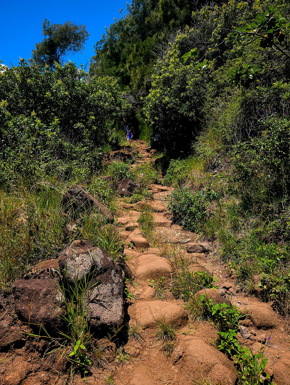
As the docents will tell you, the hike is about 2000+ feet long and drops about 500 vertical feet in 4 switchbacks. The valley is less than ½ mile wide. Your entire round trip will likely be about 2 hr or so. The top of the trail is mainly composed of clay which is incredibly slippery when wet – don’t go if it’s been raining recently! Further on it is highly eroded and shows evidence of past rockfalls along the way. It’s not a difficult trail but you will have to pick your path carefully and navigate rocks and drops in places. We’ve seen everything from people older than us (we’re mid-70s) to toddlers in flipflops, to barefoot surferrs on this trail. But we’ve also had visitors who were highly challenged by this trail, so don’t underestimate it. And if you lack time or interest in going to the bottom, do try to walk the first leg of the trail until you reach the open viewpoints, where my initial photo above was taken.
The coastline view from along the trail has many looks, depending on weather:


Here are some recent (pre-Lala) shots of the trail down to give you a sense of its condition and what you will encounter:


One of the legs has a turning point right over the ocean.


The view down from there shows the beautiful black sand that runs the length of the valley. There are always rocks along some portion of it, but how much depends on recent weather.
The last leg opens up at the bottom into a beautiful scene of ironwood trees, soft ironwood fronds (like pine needles), and small boulders everywhere. An estuary leading back into the Kohala uplands is in front of you. On a nice day, it’s a little garden of eden:

On a rainy day or after storms, the estuary and canyon beyond can be quite a bit less welcoming:


Walk towards the ocean and the coastal end of the estuary. If you are lucky, it will look something like this:


Often, storms will wash away the beach separating the estuary from the ocean, requiring that you cross in the water to see the rest of the valley. If that’s not for you, well…walk the other way along the short beach back to the cliffs and look at the sea caves and surf from there:


Enjoy it, because that’s all you can access before you hike back up…unless you take off your shoes.
If you get across the estuary, you have a beautiful, ironwood-lined valley and black sand beach to explore. The scenery varies with the season and weather history. Sometimes the valley is covered in green flowering widelia:


and often just ironwood fronds:

After storms, there can be a lot of downed trees and branches that limit travel:

On your right as you walk south, you’ll see the sand dunes and ropes preventing you from climbing them. They are beautiful though, so enjoy the view:

The beach is quite rocky and can be difficult to walk on. We almost always walk along the path in the trees next to the dunes. The view through the trees to the surf and cliffs is like a movie set:


If you arrive in the morning, often the mist coming off the surf lights up in the early sunlight:

We enjoy walking the full length of the valley until the Honokane cliffs at the far end:

We usually stop here to relax on some well-placed driftwood logs and enjoy the view back across the bay:

It may look enticing, but there are VERY few days when the water is calm enough to swim safely here. Look but don’t swim!

At the far end of the valley, the hills rise sharply towards the next ridge. There is a trail up, the ‘Awini trail, but it is usually closed (but was very recently open – so who knows). This, in principle, takes you all the way to Waipi’o Valley but that’s a multi-day trip truly for experts only.
To finish your visit, turn around here and work your way back through the valley and back up the trail. A useful tip: save some water for the trail up and be aware that the last leg up is always the hottest and it is the longest. Be ready for it!
I'll finish with a few more shots from around the valley:


Enjoy your visit, be safe, and respect this special place!


Comments